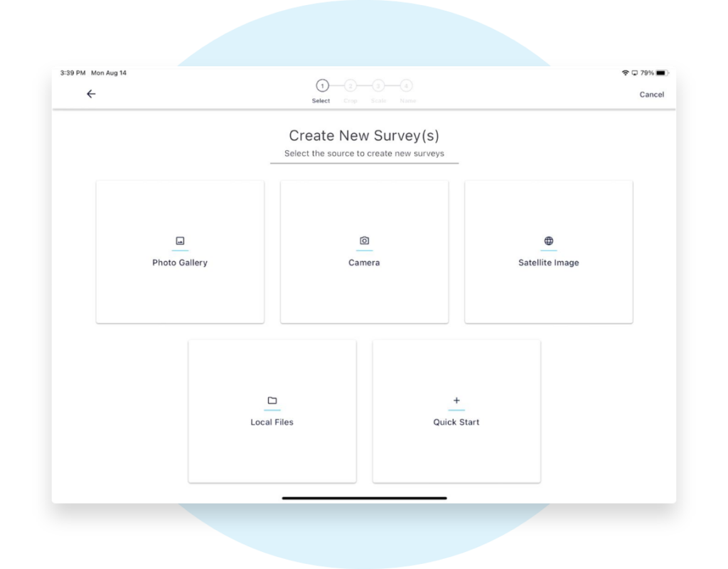
Import a floor plan to our system design software, take a picture of a fire escape plan or use our integrated Google Maps feature. Digital floor plans in no time.
Import a floor plan to convert it to a digital site survey so you can begin the system design process immediately. Here are the steps to get started:
Import a floor plan, take a photo of a fire escape plan and set the scale
Use the integrated Google Maps satellite with automatic scale
Drag-and-drop fully available, pre-made device icons for low voltage, electronic security, building management, IT, AV, facility equipment and more.
Capture photos for each device and install details
Start automating an accurate bill of materials in just a fraction of the time.
Import or capture floor plans in minutes
No more paper floor plans to design modern technology systems.
Set up a site and import floor plans in no time. The important thing is to get going in a digital floor plan so you stop wasting hours translating it for your team.
No floor plan? No problem Get started with a picture of a fire escape plan or a sketch, set the scale and start to drag-and-drop security devices. You can:
Use the integrated Google Maps for instant satellite image with automatic scale set for faster time-to-design
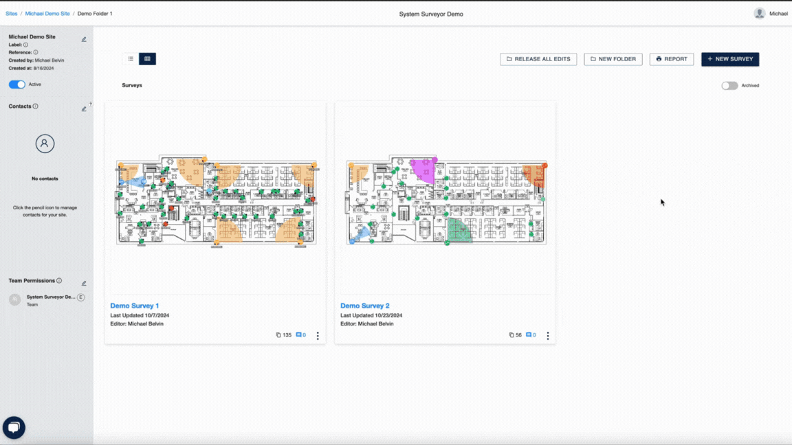
Site Survey Accuracy
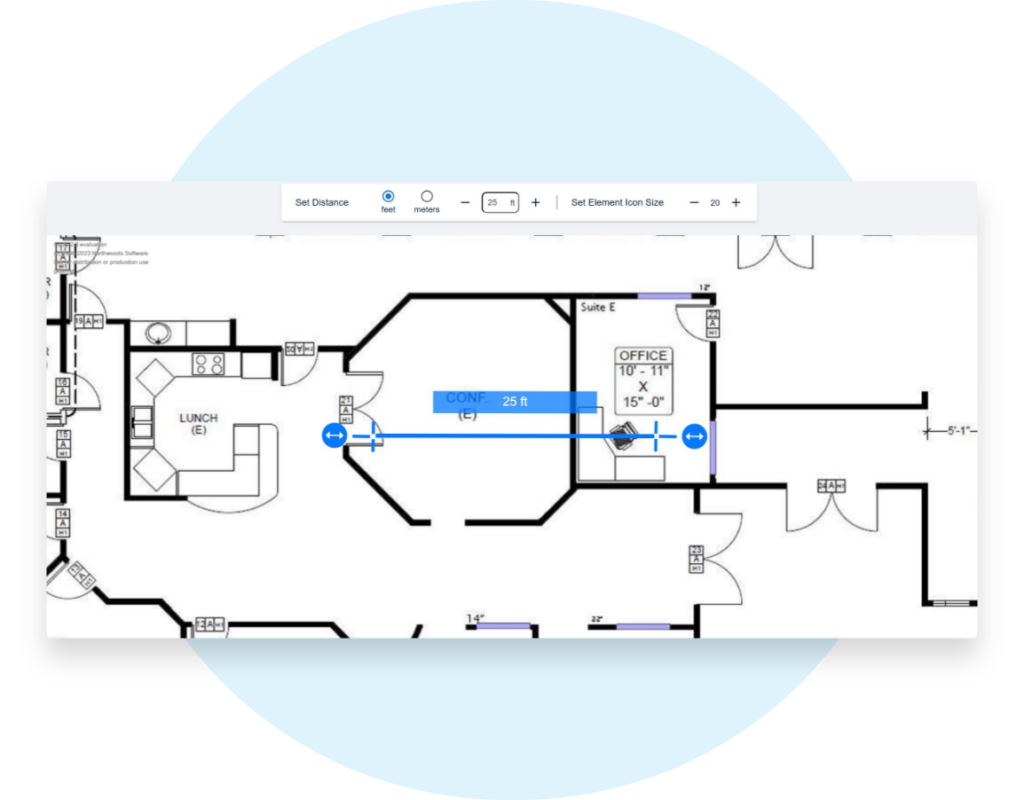
Set the scale & start designing.
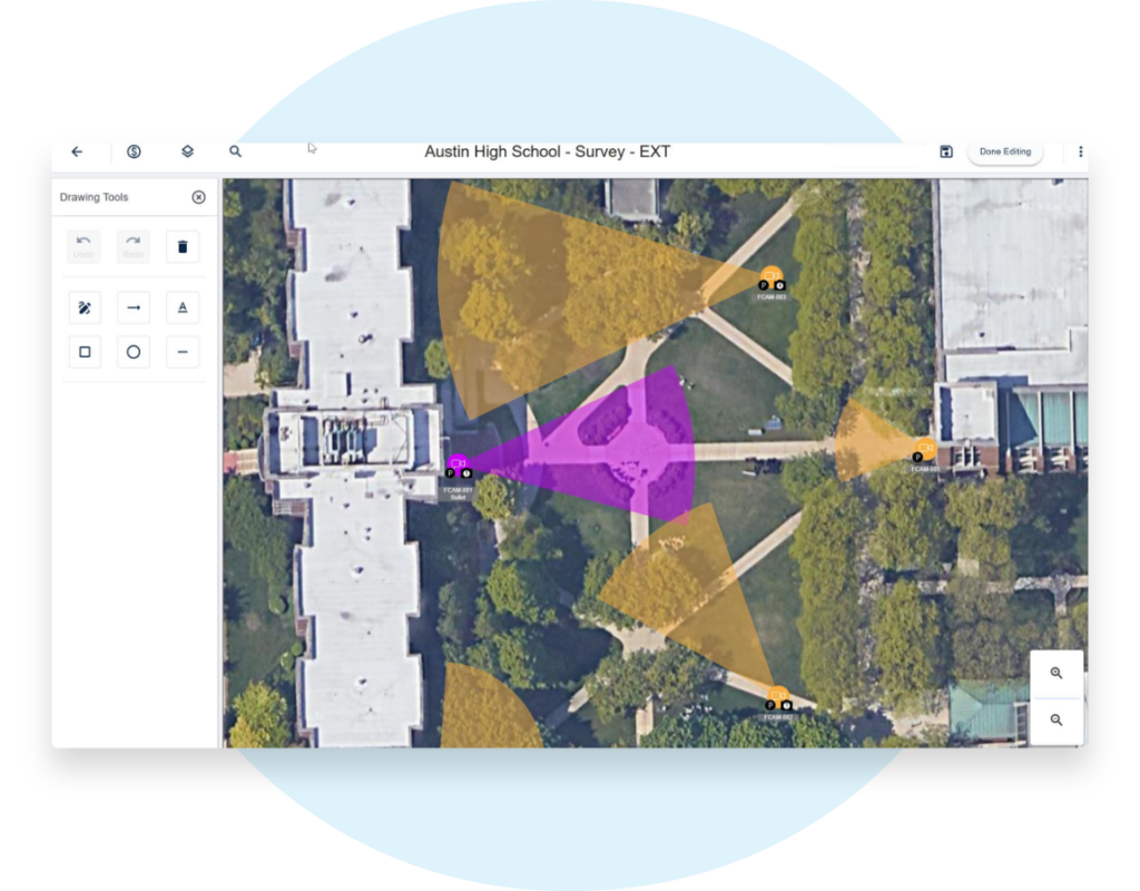
Easily set the scale for your site survey to help you design accurate systems. Enabling intelligent area of coverage calculations will allow for device recommendations, so you can choose the right camera, wireless access point, projector or sensor.
How to set the scale for your digital floor plan? It’s easy:
Grab the handles of the scaling tool and set a distance you know, like a 4 foot door
Available in imperial or metric
Automatically scales from Google Maps satellite, not need to override
Perfect for using the Area of Coverage feature for video surveillance cameras, sensors, Wi-Fi access points, projectors, lighting and so much more
Visualize with your customer or stakeholder better by setting the scale
Designing on a blank canvas
No floor plan? Take a picture and get started.
A site survey typically starts with a floor plan, but they can be hard to get your hands on. Don’t let that stop you. When a floor plan isn’t available:
Take a picture of a fire escape plan
Use the integrated Google Map and satellite integration with location-based services or simply enter an address.
Use our simple drawing tools or take a picture of your sketch – it’s still better than nothing! Then replace with the real floor plan and adjust your device icons.
Read our blog post for some more tips on how to get a floor plan or use our Quick Start option to design on a blank canvas.
“I haven’t picked up a notepad to do site walks in over a year.”
The survey is ready, now drag-and-drop elements into the system design.
Site Survey
Collaborate
System Design
Reporting
Learn More About What System Surveyor Can Do for You
At System Surveyor, we love sharing our cloud-based digital platform with others. Request a demo today, and one of our experts will be with you right away.